Blue Ridge Parkway – Milepost 85.6 – 176.1

Blog Working Folder10
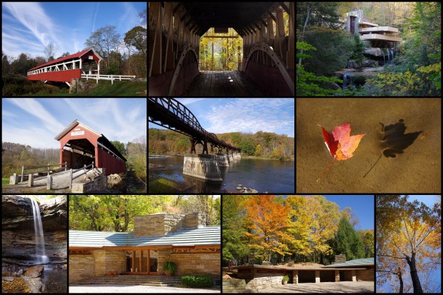
This is now day 7 of our F.A.R.T.!  In order to maximize our time on the Blue Ridge Parkway, we decided that it would be most efficient to car-camp in the campgrounds along the road.  We had read in multiple places that October is a very busy month for the BRP, so we made reservations for our campsite well in advance.  We spent our first night on the Blue Ridge Parkway in the Peaks of Otter Campground.  Our campsite was nice enough, but the bathrooms and water spigot were out of order in our section of the campground (site B16).  We didn’t receive any warning of this despite having reservations.  We could have moved to another section of the campground, but we had already set up our campsite, so we chose to stay where we were and walk to the other area of the campground.  We made chili for supper that night.  We got up with the sun so that we could pack up our campsite and get on the road before the crowds hit.

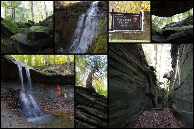
The scenery along the parkway is beautiful during the fall!

I’m a sucker for cows, barns, and cemeteries, so we stopped for a bit at the Shaver Cemetery at milepost 136.

The first big stop for this day was Mabry Mill.  We wanted to get there early in an attempt to avoid the crowds, as we read that it is one of the more popular sites along the parkway.  It certainly did not disappoint.  The mill was beautiful and still functional (which was a big plus for this engineer)!

There were several other buildings to see while at the mill.  On our way out, there was a yarn making demonstration being done, but we did not have time to stay and watch.  I did snap a few photos as we were leaving.  We had hoped to eat lunch at the restaurant, but the wait was too long.  We bought some locally-ground grits and hit the road!

Apple Orchard Falls

Blog Working Folder9

After completing our hike to White Rock Falls we continued south on the Blue Ridge Parkway.

The next hike on our list was Apple Orchard Falls.  We did an out-and-back hike that ended at the falls for a total of 2.4 miles.

These were easily the newest trail markers we’ve ever seen!

By the time we started the hike, the sun was already setting.  We knew we’d have to book it to the falls in order to be able to see them before it got dark. The foliage along the way was beautiful, and the trail was covered in leaves.

I was a bit nervous about making this hike at all because I knew that the return trip would be in the dark.  I’m so thankful that we made the decision to go ahead with the hike, as the Apple Orchard Falls were beautiful!

We went ahead and donned our headlamps before setting out on the return hike.


Making the return hike in the dark was a bit intimidating, but we didn’t encounter any issues along the way.  We’ve backpacked in the wilderness before, but we’ve never hiked after dark, so this was a first for us.  I’m thankful that we had the foresight to put our headlamps in our backpacks before setting out.

Shenandoah National Park – Lewis Falls Trail

Blog Working Folder6

Our second (and final) day in Shenandoah National Park started at sun-up.  We set out early on the Lewis Falls Trail (the trailhead is at the Big Meadows Lodge) so that we could complete the hike before checking out of our room at the lodge.  The sun was just rising and starting to peak through the trees as we started our hike.  We ate peanut butter and crackers for breakfast while we were hiking in order to make the most of our time.

We came across this doe somewhat close to the lodge.  She didn’t mind us one bit.

I’ve never seen trailmarkers like the ones used at Shenandoah.  The design is actually pretty smart, as the metal holds up much better over time than painted wooden signs.  There were quite a few trails in the area.  It was TOO COOL to see the Appalachian Trail labeled on this particular marker.  Maybe one of these days I’ll get to hike the whole Appalachian Trail, rather than just a teeny, tiny part of it (you can see that the Lewis Falls trail heads south on the Appalachian Trail).

We don’t have much of a fall or many trees where we live, so we were constantly keeping a look out for pretty leaves.  I really love the color variations in these maple leaves.

Continue reading

Shenandoah National Park – Part 2

blog-working-folder4

We picked out the hikes that we wanted to complete during our trip ahead of time.  We put quite a bit of thought into how many miles we thought we’d be able to hike (and drive) in a day.  We also tried to pick hikes that featured different things (waterfalls, good views, interesting terrain, etc.).  There are a ton of hikes to pick from, so having a game-plan ahead of time will allow you to make better use of your time.  The three hikes that we did on our first day in Shenandoah definitely reflect our thoughtful planning process.  We chose one with good views, one with good trees, and one with a waterfall.

Hike With A View

Our first hike of the day was Stony Man.  We started in the Stony Man parking area and took the Appalachian Trail to the Stony Man Trail.  We spent some time taking in the views at the Stony Man summit and then headed back to the parking lot.  The views were amazing, and the total hike distance was only 1.4 miles, so it was definitely worth the time/effort.  One of my favorite things about the view from the summit was getting to see Skyline Drive winding through the trees down below.

 Squirrel on Stony Man Trail

View from Stony Man Summit

Skyline Drive via Stony Man Summit

Skyline Drive via Stony Man Summit Continue reading

Shenandoah National Park – Part 1

blog-working-folder3

After a wonderful day in Pennsylvania’s Somerset Country, we got up early the next morning and headed out to Shenandoah National Park.  It was about a 2.5 hour long drive, so we were able to spend most of the day in Shenandoah.  Our route took us from Pennsylvania, through Maryland and West Virginia, and into Virginia.  I always get a bit of a kick when I cross a state-line, because, being from south Texas, it’s not something that I ever did on any regular basis while growing up.  Taking photographs from a moving vehicle (especially when you don’t have a good feel for when you’re going to pass the signs) is easier said than done, but I managed to get a photograph of each of the “welcome to…” signs as we crossed the state-lines that morning.

State-Line Signs

Shenandoah National Park was established on December 26, 1935, though the park was authorized back in 1926.  According to Wikipedia, 500 families were forced to give up their homes for the creation of the 105-mile-long Skyline Drive.  We started our journey through Shenandoah at the northeast entrance in Front Royal and drove south along Skyline Drive towards Waynesboro.  We received a map when we paid our entry fee and entered through the north entrance.  Once we made it into the national park, we stopped at the Dickey Ridge Visitor Center to stamp our National Parks Passport book and to pick up a few souvenirs (including the vintage-looking vinyl cling in the following collage) before making our way further into the park.

If you’re planning a visit to Shenandoah, be sure to check the park website beforehand to check for road closures, trail closures, ongoing forest fires, burn bans, etc.

Shenandoah National Park Signs

It didn’t take us very long to make our first friend in the park.  While we were driving along, this leaf fell and got stuck on our windshield.  For some reason, we were both very amused by this…maybe it’s the lack of trees where we live.

Our Shenandoah Friend Continue reading

Laurel Highlands – Pennsylvania

f-a-r1

We hadn’t initially planned to visit the Laurel Highlands, but we found ourselves in need of an area to stay for two nights that was between Cuyahoga Valley National Park and Shenandoah National Park. The Laurel Highlands region of Pennsylvania was the perfect spot. We stayed at the Quill Haven Bed and Breakfast in Somerset.  We highly recommend staying there — both for comfort and the good location…and the wonderful breakfast — if you ever find yourself in need of a place to stay in the area.

Our day in Somerset County was jam-packed and wonderful. We started our day with a self-made-tour of three covered bridges.  It is worth noting that the first bridge featured, Barronvale Bridge, is the longest covered bridge in Somerset County.  It is also worth noting that you can drive over the last bridge, Lower Humbert Bridge; we took advantage of the opportunity to drive over it, and I photographed Bryan’s car in the bridge.

 Barronvale Bridge


Barronvale Bridge

Barronvale Bridge

Continue reading

Cuyahoga Valley National Park

f-a-r

Cuyahoga Valley National Park was the first stop on our trip.  Cuyahoga Valley National Park is located in northeast Ohio and is about half an hour away from Cleveland.  It was originally established as a National Recreation Area in 1974.  It received its National Park designation in 2000.

We did three different hikes during our day at the park.  First on the list was Blue Hen Falls.  Blue Hen Falls was fairly small, about 15 feet tall according to the National Park Service website and is formed by a small stream.  The sandstone shelf that forms the waterfall, however, is picturesque, and the hike to the water fall is short, so it’s worth seeing if you’re visiting the park.  It was especially pretty during October because many of the trees in the area were changing colors.

Blue Hen Falls

Blue Hen Falls

Brandywine Falls was beautiful, though it wasn’t exactly the type of hike we expected.  A well-maintained boardwalk leads to the falls, and a road is visible above the falls (I did my best to take my photographs at an angle that hid the road).  It felt a little more commercialized (and a little less “wild”) than we expected.  In addition to walking to the waterfall, we continued on to complete the entire Brandywine Gorge Trail.  There wasn’t much to see on the trail, and we would recommend just seeing the waterfall and spending your time hiking elsewhere.

Brandywine Falls

Continue reading

2015 F.A.R.T.

fart-blog

It’s high time I got my butt in gear and start writing about the F.A.R.T. we went on last year.  The dawning of October was just the kick in the pants that I needed to get started!

You may be thinking to yourself, “Self, what in the world does F.A.R.T. stand for?”  F.A.R.T. = Fall Automobile Road Trip.  We’ve referred to this epic road-trip as the F.A.R.T. so frequently that even our fellow Young Adult Sunday School Class members started calling the trip that, as well.  You may also be wondering what the motivation was for taking a fall road trip.  This trip was truly a combination of things that Bryan and I both really like.  For starters, Bryan loves fall.  Combine that with my life-goal of visiting all of the national parks in the United States (we went to three of them during this trip) and our mutual love for hiking — and you get a trip that was made for both of us.

This trip would have been a total flop without all of the hard work that Bryan put into planning it.  He put a lot of thought into how far we could drive each day and where we would spend each night.  October is a popular time of year for Shenandoah National Park, the Blue Ridge Parkway, and Great Smoky Mountains National Park, and having reservations made months in advance for campsites, lodges, and hotels was crucial.  This itinerary is what helped keep us on track throughout the trip.  Yes, it is in Excel (we’re both engineers, we can’t help it). 🙂

In addition to the itinerary, we also had a good idea of what hikes we were going to do each day.  Prior to the trip, we bought several books (Guide to the Blue Ridge Parkway, Hiking the Blue Ridge Parkway, Hiking Great Smoky Mountains National Park, and Best Easy Day Hikes Shenandoah National Park) to help us narrow down which hikes we wanted to do.

Pre-selecting our hikes helped us to make the most of our time because we weren’t wasting time during the day trying to figure out what we were going to do next.  Here’s a list of all of the hikes that we did.  The ones that are highlighted in green are the hikes that I would wholeheartedly recommend.

The map below shows (more or less) the path we took, though it doesn’t represent the Blue Ridge Parkway very well…I gave up on trying to drag the route marker from the highway to the Blue Ridge Parkway because it wasn’t working very well.

We loaded up Bryan’s car and hit the road for what would be a road trip of epic proportions.

Trunk

Backseat 

Odometer (Beginning of F.A.R.T.)

F.A.R.T. By the Numbers
4,085 photos taken
3,756 miles driven
62.1 miles hiked
44 state license plates spotted (plus D.C.)
14 states visited
13 days traveled
3 national parks explored (plus all 469 miles of the Blue Ridge Parkway)
1 1950/1960s-style family photo taken
1 Treeing Walker Coonhound rescued

1950/1960s-Style Family Photograph

“Preserve your memories, keep them well,
what you forget you can never retell.”
-Louisa May Alcott