Good Bye, Shenandoah. Hello, Blue Ridge Parkway!

Blog Working Folder8

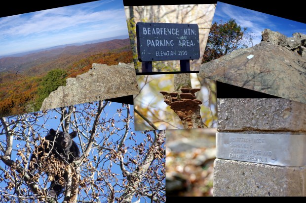
After finishing the Bear Mountain Rock Scramble hike, we continued heading South on Skyline Drive.  We stopped at several scenic overlooks before leaving the park.

Before starting our trek down the Blue Ridge Parkway, we stopped in Waynesboro, Virginia, to get gas and stock up on groceries.  In order to maximize the amount of time we could spend enjoying the Blue Ridge Parkway, we decided to go car-camping for two nights during our drive south.  We made reservations well in advance of our trip for the campgrounds — one night at the Peaks of Otter campground and one night at the Linville Falls Campground.  Prior to the trip, we planned out which hikes we thought we’d like to do, so that enabled us to figure out how many miles we thought we’d be able to drive along the parkway each day, which helped us choose what campgrounds to make reservations for.  We ended up arriving to both of our campgrounds after dark, but we felt that that helped us to make the most of our daylight hours.

We entered the Blue Ridge Parkway via the North entrance near Waynesboro.  Our first stop was a mile marker 5.8, the Humpback Rocks Visitor Center.

After getting a magnet and sticker from the visitor’s center, we made a couple of PB&J sandwiches (to eat while hiking) and set out on our first hike of the Blue Ridge Parkway leg of our trip — Humpback Rocks.  The hike was a short one, only 1.6 miles out and back, but the steep grade made it a bit more challenging than we expected.  The views from the top were totally worth it!

After completing the hike, we continued driving south along the Blue Ridge Parkway.

Our next stop was White Rock Falls.  It was an easy-to-moderate 2.5 mile hike that began at the Slacks Overlook parking lot.  The falls were rather unimpressive but could definitely be lovely in a different time of day (we were there in the afternoon) or with a larger volume of water (maybe in the spring time).

There was lovely foliage to admire along the trail.


Maple


Sassafras


Oak

We continued our drive south.  This was one of the prettiest sections of threes that we came across during the entire trip.

Shenandoah National Park – A Black Bear and Bearfence Mountain Rock Scramble

Blog Working Folder7

After checking out of our room at the Big Meadows Lodge, we continued our drive South along Skyline Drive. Up to this point I had been fairly disappointed about the amount of wildlife in the park.  That all changed as soon as we made it to the parking area for our next hike, the Bearfence Mountain Rock Scramble.

Perched high up in a tree was a black bear! He didn’t pay any attention to the small group of people stating up at him — he was much more interested in getting to the walnuts hanging in the tree he had climbed.

After watching the bear for a bit and taking a few photos, we set out on our hike.

I tend to be a bit more of a scaredy cat than my husband, so I was a little concerned about what this “rock scramble” hike would entail. The initial part of the hike was just a normal trail. As we approached the rocky area, I was relieved to see that the path for the rock scramble portion of the hike was actually painted on the rocks (note the white blazes in the photos below).

This hike ended up being one of our favorites from the entire trip. Check out the panoramic views of the surrounding area from the top!

Our trip took place during the middle of October, so there weren’t many wildflowers left by then, but there were a few still hanging on.

Shenandoah National Park – Part 2

blog-working-folder4

We picked out the hikes that we wanted to complete during our trip ahead of time.  We put quite a bit of thought into how many miles we thought we’d be able to hike (and drive) in a day.  We also tried to pick hikes that featured different things (waterfalls, good views, interesting terrain, etc.).  There are a ton of hikes to pick from, so having a game-plan ahead of time will allow you to make better use of your time.  The three hikes that we did on our first day in Shenandoah definitely reflect our thoughtful planning process.  We chose one with good views, one with good trees, and one with a waterfall.

Hike With A View

Our first hike of the day was Stony Man.  We started in the Stony Man parking area and took the Appalachian Trail to the Stony Man Trail.  We spent some time taking in the views at the Stony Man summit and then headed back to the parking lot.  The views were amazing, and the total hike distance was only 1.4 miles, so it was definitely worth the time/effort.  One of my favorite things about the view from the summit was getting to see Skyline Drive winding through the trees down below.

 Squirrel on Stony Man Trail

View from Stony Man Summit

Skyline Drive via Stony Man Summit

Skyline Drive via Stony Man Summit Continue reading

Shenandoah National Park – Part 1

blog-working-folder3

After a wonderful day in Pennsylvania’s Somerset Country, we got up early the next morning and headed out to Shenandoah National Park.  It was about a 2.5 hour long drive, so we were able to spend most of the day in Shenandoah.  Our route took us from Pennsylvania, through Maryland and West Virginia, and into Virginia.  I always get a bit of a kick when I cross a state-line, because, being from south Texas, it’s not something that I ever did on any regular basis while growing up.  Taking photographs from a moving vehicle (especially when you don’t have a good feel for when you’re going to pass the signs) is easier said than done, but I managed to get a photograph of each of the “welcome to…” signs as we crossed the state-lines that morning.

State-Line Signs

Shenandoah National Park was established on December 26, 1935, though the park was authorized back in 1926.  According to Wikipedia, 500 families were forced to give up their homes for the creation of the 105-mile-long Skyline Drive.  We started our journey through Shenandoah at the northeast entrance in Front Royal and drove south along Skyline Drive towards Waynesboro.  We received a map when we paid our entry fee and entered through the north entrance.  Once we made it into the national park, we stopped at the Dickey Ridge Visitor Center to stamp our National Parks Passport book and to pick up a few souvenirs (including the vintage-looking vinyl cling in the following collage) before making our way further into the park.

If you’re planning a visit to Shenandoah, be sure to check the park website beforehand to check for road closures, trail closures, ongoing forest fires, burn bans, etc.

Shenandoah National Park Signs

It didn’t take us very long to make our first friend in the park.  While we were driving along, this leaf fell and got stuck on our windshield.  For some reason, we were both very amused by this…maybe it’s the lack of trees where we live.

Our Shenandoah Friend Continue reading

Laurel Highlands – Pennsylvania

f-a-r1

We hadn’t initially planned to visit the Laurel Highlands, but we found ourselves in need of an area to stay for two nights that was between Cuyahoga Valley National Park and Shenandoah National Park. The Laurel Highlands region of Pennsylvania was the perfect spot. We stayed at the Quill Haven Bed and Breakfast in Somerset.  We highly recommend staying there — both for comfort and the good location…and the wonderful breakfast — if you ever find yourself in need of a place to stay in the area.

Our day in Somerset County was jam-packed and wonderful. We started our day with a self-made-tour of three covered bridges.  It is worth noting that the first bridge featured, Barronvale Bridge, is the longest covered bridge in Somerset County.  It is also worth noting that you can drive over the last bridge, Lower Humbert Bridge; we took advantage of the opportunity to drive over it, and I photographed Bryan’s car in the bridge.

 Barronvale Bridge


Barronvale Bridge

Barronvale Bridge

Continue reading

Cuyahoga Valley National Park

f-a-r

Cuyahoga Valley National Park was the first stop on our trip.  Cuyahoga Valley National Park is located in northeast Ohio and is about half an hour away from Cleveland.  It was originally established as a National Recreation Area in 1974.  It received its National Park designation in 2000.

We did three different hikes during our day at the park.  First on the list was Blue Hen Falls.  Blue Hen Falls was fairly small, about 15 feet tall according to the National Park Service website and is formed by a small stream.  The sandstone shelf that forms the waterfall, however, is picturesque, and the hike to the water fall is short, so it’s worth seeing if you’re visiting the park.  It was especially pretty during October because many of the trees in the area were changing colors.

Blue Hen Falls

Blue Hen Falls

Brandywine Falls was beautiful, though it wasn’t exactly the type of hike we expected.  A well-maintained boardwalk leads to the falls, and a road is visible above the falls (I did my best to take my photographs at an angle that hid the road).  It felt a little more commercialized (and a little less “wild”) than we expected.  In addition to walking to the waterfall, we continued on to complete the entire Brandywine Gorge Trail.  There wasn’t much to see on the trail, and we would recommend just seeing the waterfall and spending your time hiking elsewhere.

Brandywine Falls

Continue reading

TEXAS PARKS & WILDLIFE FOUNDATION – FOCUS ON THE WILD – June Contest

The subject of the June 2016 Texas Parks and Wildlife Foundation Focus on the Wild photography contest is “Texas views from the hiking trail.”  I live near Palo Duro Canyon State Park, so I figured I’d enter three of my favorite Palo Duro Canyon photographs — all of which were literally taken from hiking trails.  Check out my three entries!

The following photograph was taken from the Givens, Spicer, & Lowry Running Trail.  It’s one of my favorite trails because it’s incredibly scenic and it doesn’t have nearly as many people on it as the Lighthouse Trail.  There are quite a few places to do some off-trail exploring, too.

The following photograph of a dry creek bed and storm clouds was taken from the Lighthouse Trail.  The combination of scenery and stormy weather in this photograph always makes me pause to take a closer look.

There have been a few new trails created at Palo Duro Canyon State Park since I moved to the Texas Panhandle eight years ago.  This photograph was take while I was hiking one of them — the Rock Garden Trail.  The Rock Garden Trail directs hikers through an area that fell victim to a rock slide many moons ago.  There are quite a few interesting rock formations along the trail.  I love that you can see the Spanish skirts in the background of this photo (top right-hand quadrant).